It must be something in our genes - the desire to wander and visit different places. It doesn't matter how we achieve it, either by visiting a town for the shopping experience or a country for a tourist experience, we all do it, looking for new .........
That's what I think, anyway. Nowadays, the landscape isn't quite so wild, but it is still beautiful. And this little walk proves it. It's less than 6 miles and only 900ft of up, so not difficult and we chose a glorious Valentine's day to walk it. (See, my guy takes me to all the best places.)

 After lunch we set off aiming for Redmire and caught sight of a dragon which guards the castle.


New what though?
It's probably down to our ancestry - our predecessors were nomadic, constantly on the move searching for fresh food sources. Though food is now in the nearest supermarket it doesn't take away the urge to find. It might be new comforts or friends, smells or tastes, sights, sounds or experiences, but we constantly search for more.
And it's our ancestry that inspires us to get to the top of the next hill - where else would you get the best view of the herds to hunt, the places to camp or see where wild barley is growing. We love the sight of a healthy wild landscape because once upon a time our lives depended on it.
That's what I think, anyway. Nowadays, the landscape isn't quite so wild, but it is still beautiful. And this little walk proves it. It's less than 6 miles and only 900ft of up, so not difficult and we chose a glorious Valentine's day to walk it. (See, my guy takes me to all the best places.)
We parked in a layby just at the top of Preston Scar, next to the quarry, and picked up the footpath along the top of Scarlet Wood. As soon as we emerged from the trees two things hit us. One was the wind, which was absolutely freezing, and I mean FREEZING! It was painful against any exposed skin, such as our faces.
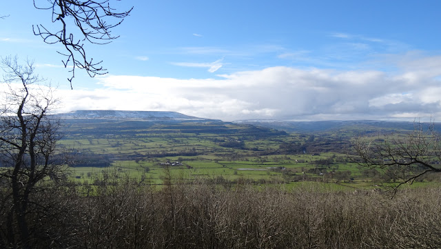
And secondly, we were hit by the views. Quite wonderful. That's Penhill on the other side of Wensleydale.

And this is lower Wensleydale opening out before us, you can see Bolton Castle on the right

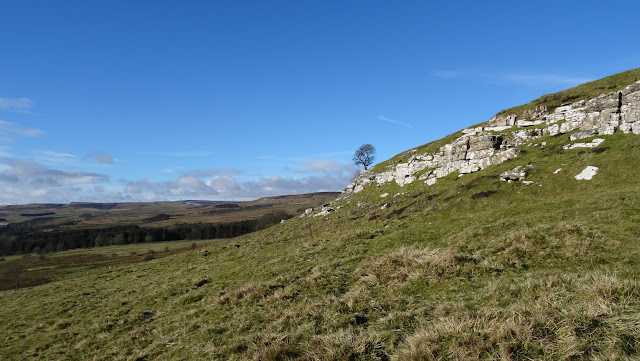
The ROW turns right just as you reach Redmire Scar, and there are many warnings from the Redmire Quarry company to keep out. This is probably for safety reasons, since the track runs alongside the quarry one side with Redmire Scar on the other - it's obvious many people ignore the signs.
We got back onto the ROW beneath Low Scar. It really was a beautiful day, the sky was so blue.

We then followed East Lane to get to village of Castle Bolton to have lunch in Bolton Castle - a warming bowl of leek and cabbage soup which steamed in the castle cafe despite the wood burner being fully stoked and roaring away.


Luckily it ignored us, I think it had already caught someone, judging by the leg sticking out of its mouth.
A look back at the castle from the fields.

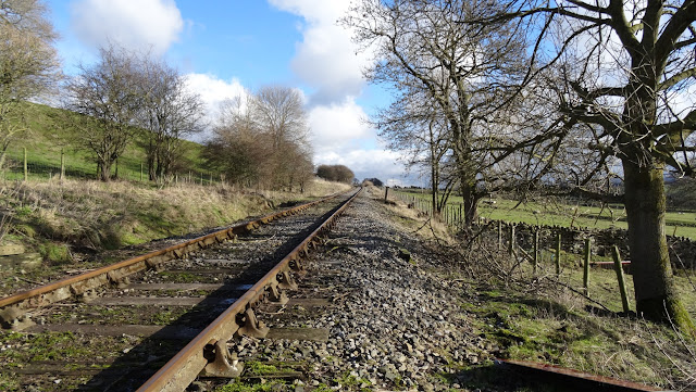
Our route took us through Redmire, to Wood End Lane and then up towards Preston-under-Scar, crossing the Redmire -Leeming Bar railway.

The bank above Preston-under-Scar was extremely steep and slippery. Better in the drier weather no doubt. The reward is more wonderful views as we got higher. This is Penhill (again), with Preston-under-Scar just below us.

And then, once at the top of the bank, it was just a short hop back to the car.
I have to say that this was a wonderful starter walk for our year, we are just testing our fitness levels and we couldn't have picked a better route or weather. Hopefully next weekend will be fine too and we we can test ourselves a little further.


